1/29/2000
Landmark information
- Location:
24 mi N of Barstow take Harvard Rd from I-15, go S 0.8 mi and turn left at Cherokee Rd. Go E ~3 mi to end of fence, S ~0.75 mi to N bank of the Mojave River - Plaque:
Official State Plaque - Site:
Nothing Remains - Date First Visited:
1/29/2000 - Date Most Recently Visited:
1/29/2000 - GPS Coordinates:
N 34 56.702, W 116 35.953
About this landmark
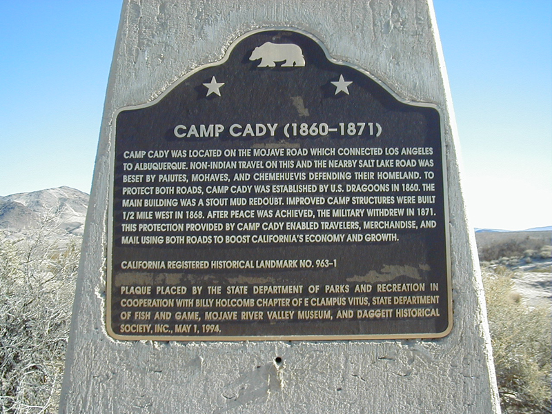
Plaque text:
Camp Cady (1860-1871)
Camp Cady was located on the Mojave Road which connected Los Angeles to Albuquerque. Non-Indian travel on this and the nearby Salt Lake Road was beset by Paiutes, Mohaves, and Chemehuevis defending their homeland. To protect both roads, Camp Cady was established by U.S. dragoons in 1860. The main building was a stout mud redoubt. Improved camp structures were built 1/2 mile west in 1868. After peace was achieved, the military withdrew in 1871. This protection provided by Camp Cady enabled travelers, merchandise, and mail using both roads to boost California's economy and growth.