6/13/2002
Landmark information
- Location:
SE corner of McArthur Rd (Co Rd A-19) and Soldier Mtn Dr, 2 mi NW of Glenburn - Plaque:
Other Plaque - Site:
Nothing Remains - Date First Visited:
6/13/2002 - Date Most Recently Visited:
6/13/2002 - GPS Coordinates:
N 41 5.318, W 121 30.856
About this landmark
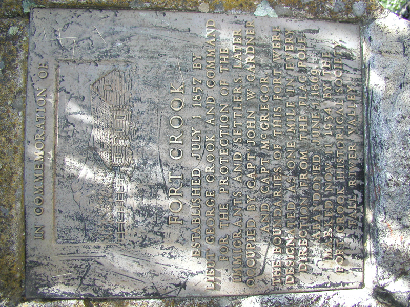
Plaque text:
In commemoration of
Fort Crook
established July 1 1857 by Lieut George Crook and command for the protection of the immigrants and settlers. Later occupied by Capt' John W Gardner and Capt McGregor.
The boundaries of this fort were designated as one mile in every direction from the flag pole. Abandoned June 1869. Marked Nov 11 1934 by the Fort Crook Historical Society, Fall River Valley.