7/12/2014
7/12/2014
7/12/2014
7/12/2014
Landmark information
- Location:
Old plaque: Civic Center Park, NE corner of El Camino Real and Lincoln St, Santa Clara
New plaque: across El Camino Real from old plaque - Plaque:
Official State Plaque - Site:
Nothing Remains - Date First Visited:
5/1/1996 - Date Most Recently Visited:
7/12/2014 - GPS Coordinates:
Old plaque: N 37 21.151, W 121 57.247
New plaque: N 37 21.128, W 121 57.246
About this landmark
Plaque text:
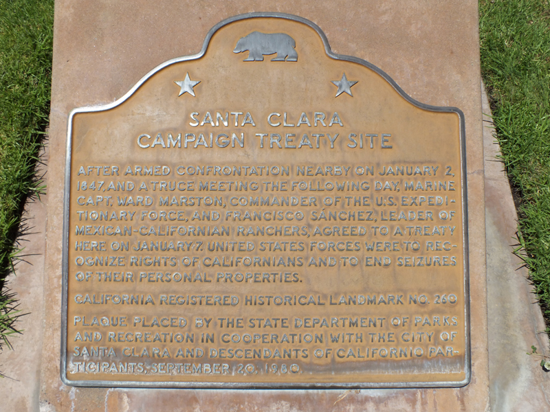
Old plaque:
Santa Clara Campaign Treaty Site
After armed confrontation nearby on January 2, 1847, and a truce meeting the following day, Marine Capt. Ward Marston, commander of the U.S. Expeditionary Forces, and Francisco Sanchez, leader of Mexican Californian ranchers, agreed to a treaty here on January 7. United States forces were to recognize rights of Californians and to end seizures of their personal properties.
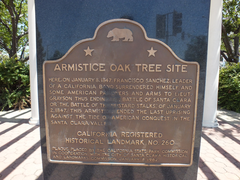
New plaque:
Armistice Oak Tree Site
Here, on January 8, 1847, Francisco Sanchez, leader of a California band surrendered himself and some American prisoners and arms to Lieut. Grayson thus ending the Battle of Santa Clara or "The Battle of the Mustard Stalks," of January 2, 1847. This armistice ended the last uprising against the tide of American conquest in the Santa Clara Valley.